Every spot on Earth, one map.
13,900+ takeoffs and landings across 249 countries, bundled for instant, offline-first loading — including 1,200+ DHV-verified German sites. Community-corrected: propose an edit and two pilots confirm it.
Every paragliding spot on one map — 13,900+ sites with live flyability tuned to your wing. A vario flight recorder that turns every flight into a cinematic 3D movie, live tracking your family can watch in a browser, and automatic SOS if a landing goes wrong.

Spots, conditions, the sky around you and your flying community — in one screen, built by a pilot.
13,900+ takeoffs and landings across 249 countries, bundled for instant, offline-first loading — including 1,200+ DHV-verified German sites. Community-corrected: propose an edit and two pilots confirm it.
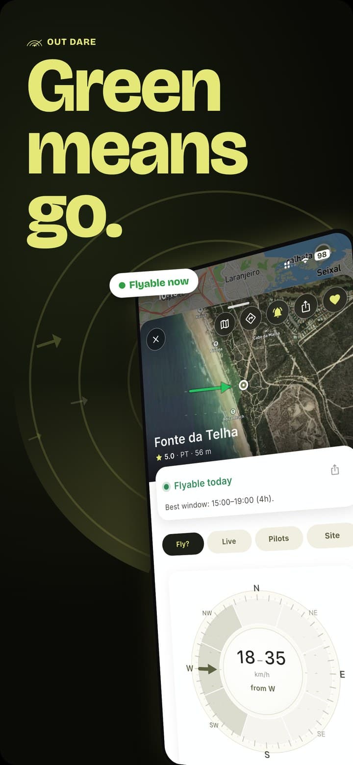
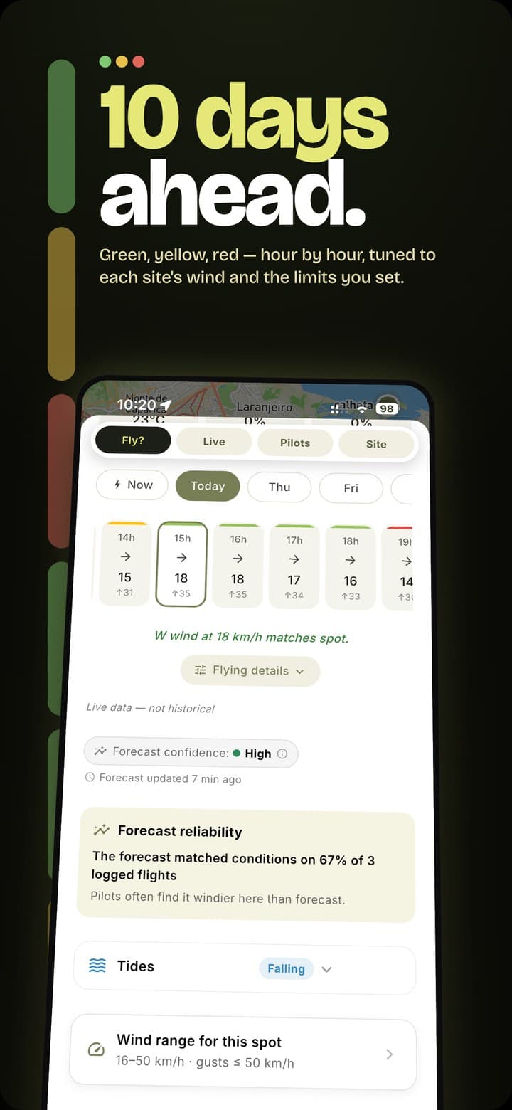
A green verdict tuned to your wind range, gust ratio — even the wind limits of the exact wing you fly. Auto-routed high-res forecasts (AROME, ICON-D2, UKV, HRRR…) with model-agreement confidence, 7 days out.
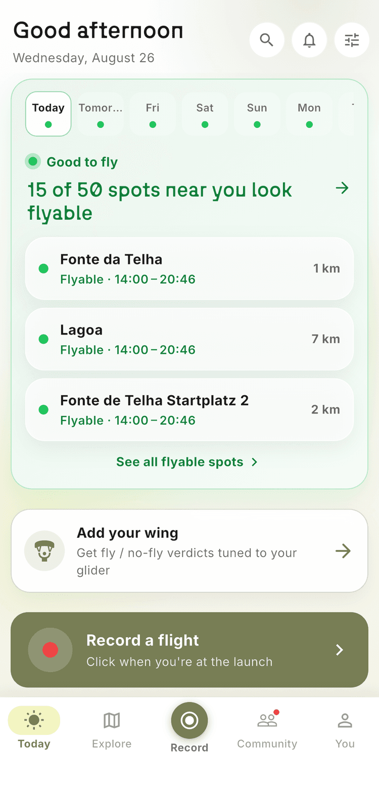
The Today dashboard follows your favorite launch and shows the week at a glance. Spot pages open on the hour the day becomes flyable, with a wind arrow that answers “which way will it blow when I'd actually fly?”
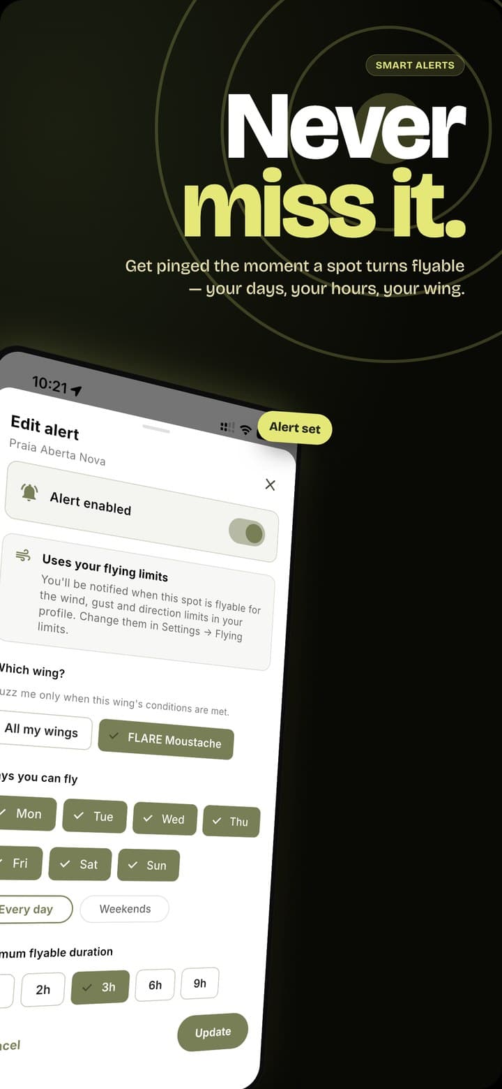
Set the wind, days and confidence you care about. OUT DARE watches the forecast and notifies you — with email fallback so a dead phone push never costs you a flyable day. No account required.
Every spot shows who flew it — today, this month, all time — with a year heatmap, busiest hours, regulars and trending launches near you. Fresh flyability proof from real recorded flights, not hearsay.
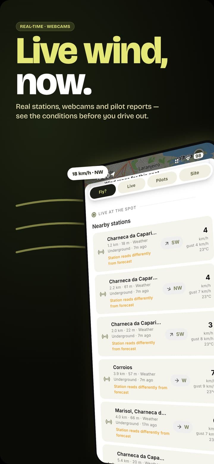
Live wind stations (METAR, Holfuy, Pioupiou…), webcams, openAIP airspace, kk7 thermal hotspots — even power lines. Toggle each layer right on the map, with tide times at coastal spots.
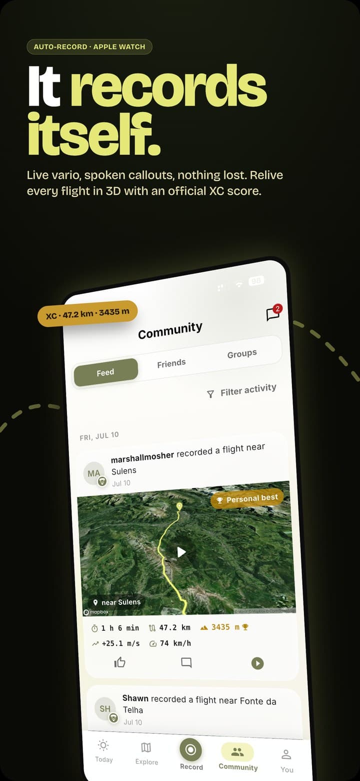
Add spots, fix directions, drop photos and star reviews — sensitive edits need two confirmations before they go live. Then plan it together: groups for clubs and schools, chats with photos and voice notes, and a feed with kudos when your friends fly.
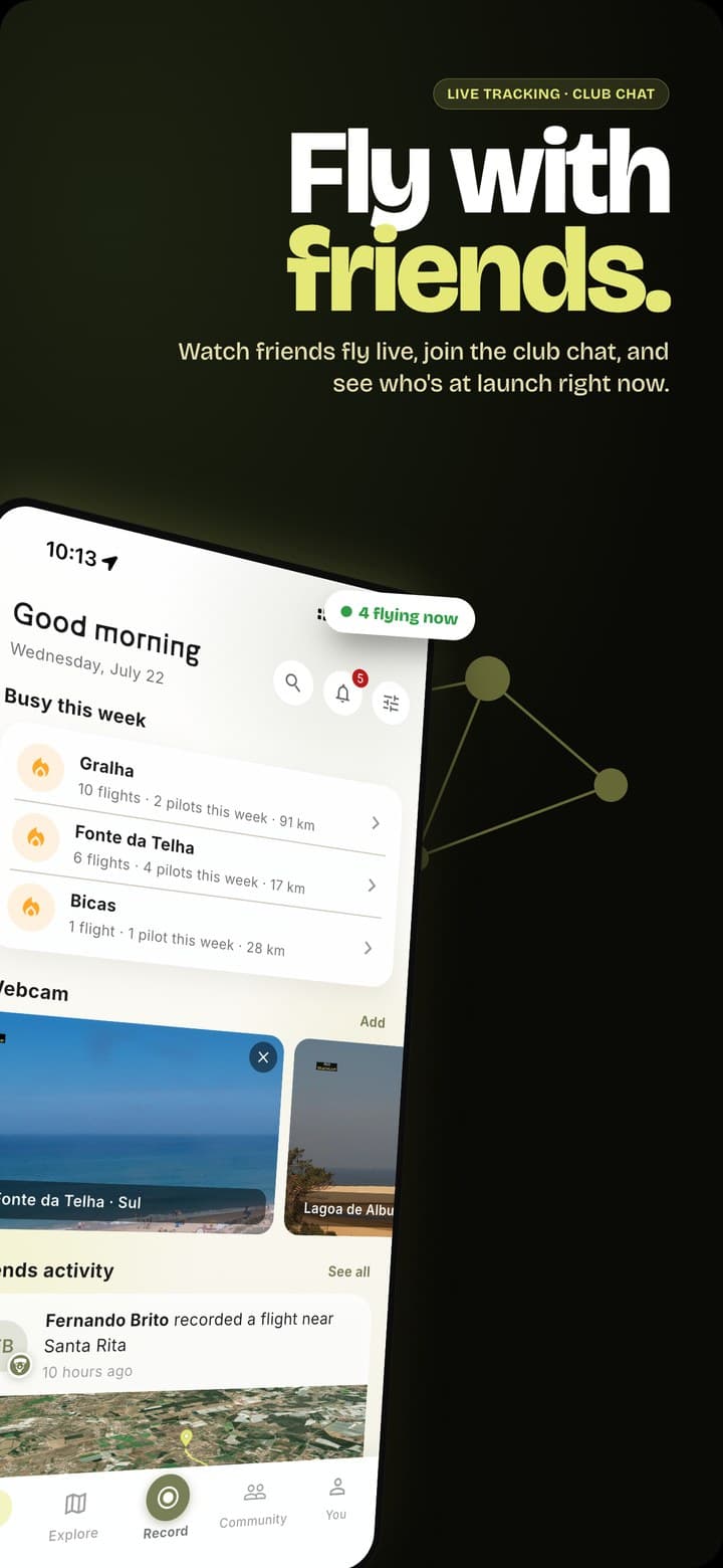
A vario in your pocket, a film crew on your track and your friends live on the map — every flight saved, on the device, free.
Relive your flight as a drone-style 3D flyover over real satellite terrain — then export a cinematic video, rendered on your phone, ready for the group chat and the 'gram.
GPS + barometric logging with audio vario, a thermal assistant that points to the core, spoken callouts and a crash-safe logbook. Forgot to press start? Shadow recording still saved your flight.
Watch friends fly live in 3D, see paragliders and gliders around you from the Open Glider Network, and share one link anyone can open in a browser — no app needed. LiveTrack24 push included.
One-tap record, a glanceable cockpit HUD and a vario you can feel through haptics. Plus a logbook that syncs to your account — import your XContest history, claim flights in one tap.
Paragliding is safest when the right people know where you are. OUT DARE makes that automatic.
After a hard landing with no movement, a countdown fires — and unless you cancel it, your emergency contacts and pilots flying within 40 km get your exact location.
Your blood type, allergies, medication and emergency contacts on one printable QR sticker — first responders scan it and see what matters, in their browser, instantly.
Share your personal live link with family and retrieve drivers — position, altitude and speed in any browser, with an honest “probably landed” state. No account, no download.
In-flight airspace proximity warnings, power-line and obstacle layers with real height above ground, and a glide-range overlay — the dangerous stuff, visible before it matters.

It started with a frustration every pilot knows: four tabs open, wind from one, webcams from another, never quite sure if it was on. So we put the whole pre-flight in one place — and kept building until it flew with us.
Built by a pilot, for pilots. Free, and improved 500+ times in the last month alone.
Risk better. Out dare.
Yes — completely. Every feature, from the 13,900+ spot map to the 3D flight videos, live tracking and SOS, is free. No subscription, no paywall, no locked screens.
iOS 15+ and Android, with an Apple Watch companion app (one-tap record, haptic vario) and a web app at fly.outdare.app for the big screen.
13,900+ takeoffs and landings across 249 countries, bundled with the app so the map works offline — including 1,200+ DHV-verified German sites, plus community submissions validated by two pilots.
Each spot is auto-routed to the best high-resolution model for its region — AROME (1.5 km), ICON-D2, UKV, MET Nordic, HRRR — with a 7-day outlook and a confidence rating based on model agreement, cross-checked against live wind stations.
For most flying, yes: GPS + barometric recording, responsive audio vario, thermal assistant, wind estimate and spoken callouts. External Bluetooth varios (BlueFly, FlyNet, LK8EX1) are supported too.
Yes — share your personal live link and they can watch your position, altitude and speed in any browser, no app or account needed. And if a hard landing knocks you out, automatic SOS alerts your emergency contacts with your exact location.
Import your entire XContest archive or IGC files from any app (XCTrack, XCSoar…). Flights sync to your account, export as PDF, and can be claimed to XContest in one tap.
The full spot database ships inside the app, so the map and site info work with no signal. Forecasts, webcams and live layers refresh whenever you're back online.

Download OUT DARE free. Start exploring spots instantly — no account needed.